| Wetterinfo | METAR TAF |
| Koordinaten | 34.5743W 117.1864E |
| Typ | Midsized airport |
| Land | United States (Vereinigte Staaten von Amerika) weitere Länder... |
| Gehört zu | Apple Valley |
| Orte in der Nähe | Apple Valley, Victorville, Spring Valley Lake, Mountain View Acres, Hesperia, Adelanto, Silver Lakes, Lucerne Valley, Oak Hills, Lenwood, |
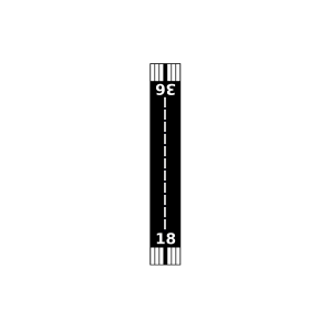
| Landebahnen | 08/26, 18/36 |
| Fluginformation (FIR) | Los Angeles |
| Runway | RWY-Richtung | Seitenwind | Gegenwind |
|---|---|---|---|
| 08/26 | 90°/270° | - | - |
| 18/36 | 196°/16° | - | - |
| Osborne Airport | 7 km | - | - | |||
| Holiday Ranch Airport | 10 km | - | - | |||
| KVCV | Southern California Logistics Airport | 18 km | METAR | TAF | ||
| Hesperia Airport | 25 km | - | - | |||
| Adelanto Airport | 25 km | - | - | |||
| Lake Arrowhead Airport | 30 km | - | - | |||
| Depue Airport | 32 km | - | - | |||
| Krey Field | 34 km | - | - | |||
| Sun Hill Ranch Airport | 35 km | - | - | |||
| El Mirage Field Adelanto | 38 km | - | - | |||
| Hansen Airport | 43 km | - | - | |||
| KGXA | Palmdale Weather Station | 44 km | - | - | ||
| Gray Butte Field | 44 km | - | - | |||
| Big Bear City Airport | 46 km | - | - | |||
| KDAG | Barstow-Daggett Airport | 48 km | METAR | TAF |