logo
freizeitwetter .info
Impressum Nutzungsbedingungen Attributions

© Schulkreis.de e.K.
Freizeitwetter.info Version 3.5.4

Alle Angaben ohne Gewähr. Daten nur zu Demozwecken verwenden!

6°C
5°C
13°C

US-C207

Bishop Field


0 km/h
Flugplatzdetails
Wetterinfo- -
Koordinaten32.8751W 96.2878E
TypSmall airport
LandUnited States (Vereinigte Staaten von Amerika) weitere Länder...
Gehört zuRoyse City
Orte in der Nähe McLendon-Chisholm, Fate, Royse City, Quinlan, Terrell, Rockwall, Heath, Travis Ranch, Nevada, Josephine,
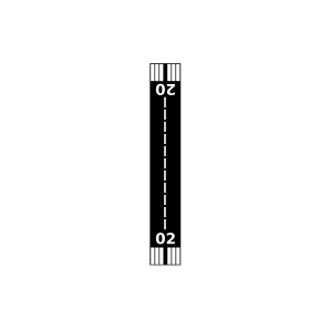
Landebahnen 02/20
Fluginformation (FIR)Ft Worth
Umgebungskarte Bishop Field

Anflug-Informationen

Klicke den Kompass an, um die Landebahn in Position zu drehen.
0 km/h

Landebahn-Informationen

Liste der verfügbaren Landebahnen, vermutlich aktive Piste hervorgehoben.
Runway RWY-Richtung Seitenwind Gegenwind
02/20 20°/200° - -

Wettervorhersage (DWD)

Station:
Keine Wetterdaten vorhanden.

Flugplätze in der Nähe

Poetry Landing Airport 3 km - -
Poetry Flying Ranch Airport 6 km - -
Airpark East 9 km - -
Thorny Woods Airport 10 km - -
Klutts Field 10 km - -
Flying 'T' Ranch Airport 10 km - -
Lagrone Ranch Airport 13 km - -
Ralph M Hall/Rockwall Municipal Airport 15 km - -
Caddo Mills Municipal Airport 18 km - -
KTRL Terrell Municipal Airport 19 km METAR TAF
Kudlacek Field 19 km - -
Rockin M Airport 20 km - -
Smith Field 20 km - -
Weese International Airport 23 km - -
Mcbee Field 25 km - -
Flying G Airport 26 km - -
Lazy Dog Ranch Airpark 26 km - -
Sunset Airport 26 km - -
Twisted JS Airport 26 km - -
Jlinn Airport 26 km - -
KHQZ Mesquite Metro Airport 27 km METAR TAF
Richie Rich Airport 27 km - -
Madeira Airpark 29 km - -
KGVT Majors Airport 30 km METAR TAF
Flying M Airport 31 km - -
Mullins Landing Airport 31 km - -
Reeder Airport 32 km - -
Short Stop Airport 32 km - -
Fly-N-Ski Airport 34 km - -
Van Zandt County Regional Airport 36 km - -
Leinart Farms Airstrip Airport 36 km - -
Flyers Field 36 km - -
Baum Airport 36 km - -
Fordlane Flyers Airport 37 km - -
Seagoville Airport 37 km - -
Moore Airport 38 km - -
Sword's Landing Airport 40 km - -
Bucker Field 40 km - -
R-Ranch Airstrip Airport 41 km - -
Erco Field 42 km - -
Glenmar Airport 42 km - -
Olympus Airport 43 km - -
KTKI Mckinney National Airport 44 km METAR TAF
Culp Airport 44 km - -
Dennis's Flying Farm Airport 45 km - -
Card Aerodrome Airport 45 km - -
Embarcadero Airport 48 km - -
Goode Field 49 km - -
Square Air Airport 49 km - -
Thompson Field 49 km - -
Vogt's Vista Airport 49 km - -
Blue Ridge Airport 49 km - -
Claassen Airport 50 km - -
Alle Angaben ohne Gewähr. Daten nur zu Demozwecken verwenden!