| Wetterinfo | METAR TAF |
| Koordinaten | 41.6883W 69.9897E |
| Typ | Midsized airport |
| Land | United States (Vereinigte Staaten von Amerika) weitere Länder... |
| Gehört zu | Chatham |
| Orte in der Nähe | West Chatham, Chatham, East Harwich, Harwich Center, Harwich, Harwich Port, Northwest Harwich, Brewster, Orleans, Dennis Port, |
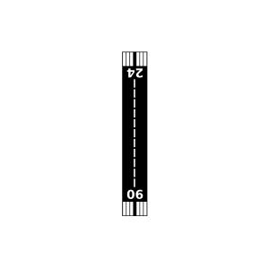
| Landebahnen | 06/24 |
| Fluginformation (FIR) | Boston |
| Runway | RWY-Richtung | Seitenwind | Gegenwind |
|---|---|---|---|
| 06/24 | 44°/224° | - | - |
| Long Pond Seaplane Base | 8 km | - | - | |||
| KHYA | Cape Cod Gateway Airport | 24 km | METAR | TAF | ||
| Cape Cod Airport | 34 km | - | - | |||
| Marston Mills Seaplane Base | 36 km | - | - | |||
| KFMH | Cape Cod Coast Guard Air Station | 44 km | METAR | TAF | ||
| KPVC | Provincetown Municipal Airport | 47 km | METAR | TAF | ||
| Muskeget Island Airport | 47 km | - | - | |||
| Falmouth Airpark | 47 km | - | - | |||
| KACK | Nantucket Memorial Airport | 49 km | METAR | TAF |