| Wetterinfo | - - |
| Koordinaten | 3.2953S 136.4083E |
| Typ | Small airport |
| Land | Indonesia (Indonesien) weitere Länder... |
| Gehört zu | |
| Orte in der Nähe | Homeyo, Bugalaga, |
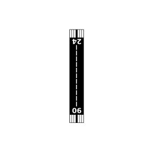
| Landebahnen | 06/24 |
| Fluginformation (FIR) | Ujung Pandang |
| Runway | RWY-Richtung | Seitenwind | Gegenwind |
|---|---|---|---|
| 06/24 | 67°/247° | - | - |
| Baya Biru Airport | 39 km | - | - | |||
| Bugalaga Airstrip | 42 km | - | - | |||
| Zotadi Airstrip | 46 km | - | - | |||
| Pagamba Airstrip | 49 km | - | - | |||
| Kiman Airport | 49 km | - | - |