| Wetterinfo | - - |
| Koordinaten | 31.2187W 93.7019E |
| Typ | Small airport |
| Land | United States (Vereinigte Staaten von Amerika) weitere Länder... |
| Gehört zu | Fairmount |
| Orte in der Nähe | Hemphill, Milam, Sam Rayburn, Newton, New Llano, Leesville, Jasper, Many, Zwolle, Fort Polk South, |
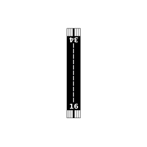
| Landebahnen | 16/34 |
| Fluginformation (FIR) | Houston |
| Runway | RWY-Richtung | Seitenwind | Gegenwind |
|---|---|---|---|
| 16/34 | 160°/340° | - | - |
| Scrappin Valley Airport | 14 km | - | - | |||
| Pineland Municipal Airport | 27 km | - | - | |||
| Leesville Airport | 35 km | - | - | |||
| Ammons Airport | 35 km | - | - | |||
| Newton Municipal Airport | 37 km | - | - | |||
| Prairie Creek Airport | 41 km | - | - | |||
| Hart Airport | 42 km | - | - | |||
| Fairway Farm Airport | 43 km | - | - | |||
| KAQV | Peason Ridg/Polk Weather Station | 43 km | - | - | ||
| KJAS | Jasper County/Bell Field | 49 km | METAR | TAF |