| Wetterinfo | - - |
| Koordinaten | 3.9765S 137.6222E |
| Typ | Small airport |
| Land | Indonesia (Indonesien) weitere Länder... |
| Gehört zu | Illaga-Papua Island |
| Orte in der Nähe | Ilaga, Mulia, |
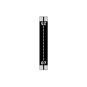
| Landebahnen | 07/25 |
| Fluginformation (FIR) | Ujung Pandang |
| Runway | RWY-Richtung | Seitenwind | Gegenwind |
|---|---|---|---|
| 07/25 | 80°/260° | - | - |
| Illaga III Airport | 4 km | - | - | |||
| WABL | Illaga Airport | 17 km | - | - | ||
| Beoga Airport | 28 km | - | - | |||
| Sinak Airport | 30 km | - | - | |||
| Jila Airstrip | 30 km | - | - | |||
| Alama Airstrip | 44 km | - | - | |||
| Aideralma Airstrip | 46 km | - | - | |||
| WAJM | Mulia Airport | 48 km | - | - |