logo
freizeitwetter .info
Impressum Nutzungsbedingungen Attributions

© Schulkreis.de e.K.
Freizeitwetter.info Version 3.5.4

Alle Angaben ohne Gewähr. Daten nur zu Demozwecken verwenden!

K04G

Lansdowne Airport


0 km/h
Flugplatzdetails
Wetterinfo- -
Koordinaten41.1305W 80.6196E
TypSmall airport
LandUnited States (Vereinigte Staaten von Amerika) weitere Länder...
Gehört zuYoungstown
Orte in der Nähe Youngstown, Hubbard, Churchill, Campbell, Girard, Struthers, McDonald, McKinley Heights, Masury, Poland,
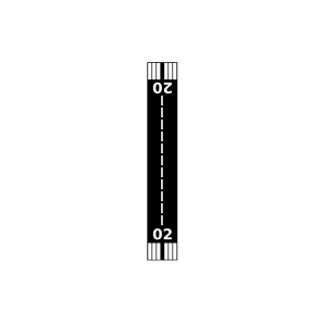
Landebahnen 02/20
Fluginformation (FIR)Cleveland
Umgebungskarte Lansdowne Airport

Anflug-Informationen

Klicke den Kompass an, um die Landebahn in Position zu drehen.
0 km/h

Landebahn-Informationen

Liste der verfügbaren Landebahnen, vermutlich aktive Piste hervorgehoben.
Runway RWY-Richtung Seitenwind Gegenwind
02/20 16°/196° - -

Wettervorhersage (DWD)

Station:
Keine Wetterdaten vorhanden.

Flugplätze in der Nähe

J And B Sky Ranch Airport 8 km - -
Smith-Stewart Field 10 km - -
West Middlesex Airport 11 km - -
Brocker Field 14 km - -
KYNG Youngstown/Warren Regional Airport 15 km METAR TAF
Mahoning County Joint Vocational School Airport 17 km - -
Bieber's Seaplane Base 17 km - -
Wetzl Airport 18 km - -
Bieber Field 18 km - -
Kenley Airport 19 km - -
Giovannone Airport 19 km - -
Griffin/Sloas Airport 19 km - -
Youngstown Elser Metro Airport 19 km - -
KUCP New Castle Municipal Airport 21 km METAR TAF
Oldstown Flying Tails Airport 26 km - -
Petersburg Airport 26 km - -
Allen Airport 27 km - -
Bartsch Airport 28 km - -
Napodano Airport 28 km - -
Salem Airpark 29 km - -
Reno Airport 29 km - -
Urban Airport 29 km - -
Warren Airport 30 km - -
Flemming Field 30 km - -
Braceville Airport 31 km - -
Aero Flight Center Airport 31 km - -
Barnes Farmland Airport 31 km - -
Circle C Airport 32 km - -
Dunn Field 32 km - -
York Aerodrome Airport 33 km - -
Mosquito Strip Airport 33 km - -
Jackson Airport 33 km - -
Gustavus Airport 35 km - -
Koons Airport 35 km - -
Nelson's Run Airport 37 km - -
Mcmillin Landingstrip Airport 37 km - -
Grove City Airport 38 km - -
Bristol Airstrip Airport 39 km - -
Ferrell Field 39 km - -
Miller Airport 39 km - -
Greenville Municipal Airport 40 km - -
Tri-City Airport 41 km - -
Lake Arthur Field 42 km - -
Hal Joy Airfield 42 km - -
Lee Field 44 km - -
KBVI Beaver County Airport 44 km METAR TAF
Alliance Airport 45 km - -
Flying M Ranch Airport 45 km - -
Pleasant Hill Airport 45 km - -
Gates Airport 47 km - -
Far View Airport 48 km - -
Jetway Airport 50 km - -
Alle Angaben ohne Gewähr. Daten nur zu Demozwecken verwenden!