| Wetterinfo | - - |
| Koordinaten | 47.5672W 114.1011E |
| Typ | Small airport |
| Land | United States (Vereinigte Staaten von Amerika) weitere Länder... |
| Gehört zu | Ronan |
| Orte in der Nähe | Pablo, Ronan, Polson, |
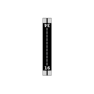
| Landebahnen | 16/34 |
| Fluginformation (FIR) | Salt Lake |
| Runway | RWY-Richtung | Seitenwind | Gegenwind |
|---|---|---|---|
| 16/34 | 180°/0° | - | - |
| Hoversland Airport | 5 km | - | - | |||
| Polson Airport | 16 km | - | - | |||
| St. Ignatius Airport | 27 km | - | - | |||
| Condon Us Forest Service Airport | 29 km | - | - | |||
| Candylands Airport | 29 km | - | - | |||
| Hot Springs Airport | 39 km | - | - | |||
| Lakeside Airport | 48 km | - | - |