| Wetterinfo | - - |
| Koordinaten | 42.7637W 112.1849E |
| Typ | Small airport |
| Land | United States (Vereinigte Staaten von Amerika) weitere Länder... |
| Gehört zu | Inkom |
| Orte in der Nähe | Pocatello, Chubbuck, Tyhee, Fort Hall, Soda Springs, Blackfoot, |
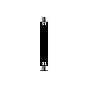
| Landebahnen | 01/19 |
| Fluginformation (FIR) | Salt Lake |
| Runway | RWY-Richtung | Seitenwind | Gegenwind |
|---|---|---|---|
| 01/19 | 10°/190° | - | - |
| Lava Hot Springs Airpark | 21 km | - | - | |||
| Bancroft Municipal Airport | 26 km | - | - | |||
| KPIH | Pocatello Regional Airport | 37 km | METAR | TAF | ||
| Downey/Hyde Memorial/ Airport | 38 km | - | - | |||
| Simpson Airport | 41 km | - | - | |||
| W E Ranch Airport | 48 km | - | - |