| Wetterinfo | - - |
| Koordinaten | 27.2616W 108.2932E |
| Typ | Small airport |
| Land | Mexico (Mexiko) weitere Länder... |
| Gehört zu | Guazapares |
| Orte in der Nähe | Témoris, Cerocahui, Bahuichivo, Chínipas, Milpillas, Urique, San Rafael, |
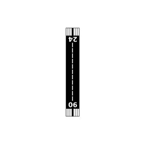
| Landebahnen | 06/24 |
| Fluginformation (FIR) | Mexico |
| Runway | RWY-Richtung | Seitenwind | Gegenwind |
|---|---|---|---|
| 06/24 | 63°/243° | - | - |
| Mina de Palmarejo Airport | 18 km | - | - | |||
| Chinipas Airport | 29 km | - | - | |||
| Urique Airport | 38 km | - | - | |||
| El Duraznito Airstrip | 49 km | - | - |