logo
freizeitwetter .info
Impressum Nutzungsbedingungen Attributions

© Schulkreis.de e.K.
Freizeitwetter.info Version 3.5.4

Alle Angaben ohne Gewähr. Daten nur zu Demozwecken verwenden!

US-D691

Terhark Airport


0 km/h
Flugplatzdetails
Wetterinfo- -
Koordinaten42.66W 88.4308E
TypSmall airport
LandUnited States (Vereinigte Staaten von Amerika) weitere Länder...
Gehört zuElkhorn
Orte in der Nähe Como, Lake Geneva, Elkhorn, Burlington, Williams Bay, Bohners Lake, East Troy, Pell Lake, Powers Lake, Browns Lake,
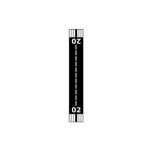
Landebahnen 02/20
Fluginformation (FIR)Chicago
Umgebungskarte Terhark Airport

Anflug-Informationen

Klicke den Kompass an, um die Landebahn in Position zu drehen.
0 km/h

Landebahn-Informationen

Liste der verfügbaren Landebahnen, vermutlich aktive Piste hervorgehoben.
Runway RWY-Richtung Seitenwind Gegenwind
02/20 20°/200° - -

Wettervorhersage (DWD)

Station:
Keine Wetterdaten vorhanden.

Flugplätze in der Nähe

Plows & Props Airport 3 km - -
Fletcher Airport 6 km - -
Wag-Aero Airport 6 km - -
Grand Geneva Resort Airport 6 km - -
Barker Strip Airport 10 km - -
KBUU Burlington Municipal Airport 11 km METAR TAF
Lake Geneva Aire Estates Airport 11 km - -
Lake Lawn Airport 14 km - -
Paddock Field 15 km - -
East Troy Municipal Airport 16 km - -
Air Troy Estates Airport 17 km - -
Swan Airport 18 km - -
Fox River Airport 18 km - -
Tamarack Airport 22 km - -
Big Foot Airfield 23 km - -
Bountiful Acres Airport 23 km - -
Kirkpatrick Airport 24 km - -
Ori Airport 24 km - -
Digger Dougs Airport 24 km - -
Ames Private Airport 26 km - -
Camp Lake Airport 27 km - -
Richardson Field 27 km - -
Midland Airport 28 km - -
Palmyra Municipal Airport 28 km - -
Horner Farms Airport 29 km - -
Galt Field 29 km - -
Clover Valley Airport 30 km - -
Pillow Hill Airport 30 km - -
Barten Airport 30 km - -
Cindy Guntly Memorial Airport 32 km - -
Great Lakes Seaplane Base 33 km - -
Dacy Airport 33 km - -
Pine Hill Airport 33 km - -
Johnstown Center Airport 34 km - -
Valhalla Airport 34 km - -
Gutzmer's Twin Oaks Airport 34 km - -
SD Aero Airport 34 km - -
Potts Field 35 km - -
Binzel Airport 35 km - -
Heitman Field 35 km - -
Dutch Creek Seaplane Base 35 km - -
Aero Estates Airport 36 km - -
Winfield 36 km - -
Melin Farms Airport 37 km - -
Dutch Gap Airstrip Airport 37 km - -
Bristol Airport 38 km - -
Hacklander Airport 38 km - -
Adkins Airport 38 km - -
Donald Alfred Gade Airport 39 km - -
Sylvania Airport 39 km - -
Hilbert Airport 39 km - -
Oakbrook Airport 40 km - -
Sullivan Airport 41 km - -
KENW Kenosha Regional Airport 42 km METAR TAF
Lee Creek Airport 43 km - -
Maggies Farm LLC Airport 43 km - -
Faken Airport 43 km - -
Flying Q Farm Airport 44 km - -
Compass Rose Airport 45 km - -
Aerogrange Airport 45 km - -
KUES Waukesha County Airport 45 km METAR TAF
McCurdy Strip Airport 45 km - -
Blackhawk Island Airport 45 km - -
Christie Aerodrome Airport 46 km - -
Battle Creek Airport 46 km - -
Fort Atkinson Municipal Airport 46 km - -
Bob Walberg Field 47 km - -
Campbell Airport 47 km - -
Beloit Airport 48 km - -
Jackson Seaplane Base 48 km - -
Herbert C Maas Airport 48 km - -
Phyllis Field 49 km - -
Alle Angaben ohne Gewähr. Daten nur zu Demozwecken verwenden!