| Mittwoch11.11. | Donnerstag12.11. | Freitag13.11. | Samstag14.11. | Sonntag15.11. | Montag16.11. | Dienstag17.11. |
-
- |
-
- |
-
- |
-
- |
-
- |
-
- |
-
- |
| Wetterinfo | - - |
| Koordinaten | 44.1059W 70.956E |
| Typ | Small airport |
| Land | United States (Vereinigte Staaten von Amerika) weitere Länder... |
| Gehört zu | Fryeburg |
| Orte in der Nähe | Lovell, Fryeburg, North Conway, Brownfield, Conway, Denmark, Bridgton, Harrison, Madison, Hiram, |
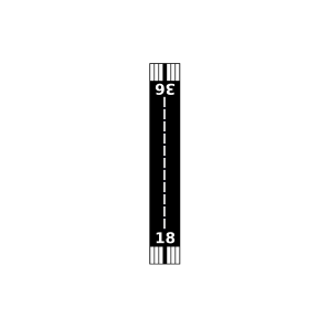
| Landebahnen | 18/36 |
| Fluginformation (FIR) | Boston |
| Runway | RWY-Richtung | Seitenwind | Gegenwind |
|---|---|---|---|
| 18/36 | 180°/0° | - | - |
| Mittwoch 08:00 |
Mittwoch 09:00 |
Mittwoch 10:00 |
Mittwoch 11:00 |
Mittwoch 12:00 |
Mittwoch 13:00 |
Mittwoch 14:00 |
Mittwoch 15:00 |
Mittwoch 16:00 |
Mittwoch 17:00 |
Mittwoch 18:00 |
Mittwoch 19:00 |
Mittwoch 20:00 |
Mittwoch 21:00 |
Mittwoch 22:00 |
Mittwoch 23:00 |
Donnerstag 00:00 |
Donnerstag 01:00 |
Donnerstag 02:00 |
Donnerstag 03:00 |
Donnerstag 04:00 |
Donnerstag 05:00 |
Donnerstag 06:00 |
Donnerstag 07:00 |
Donnerstag 08:00 |
Donnerstag 09:00 |
Donnerstag 10:00 |
Donnerstag 11:00 |
Donnerstag 12:00 |
Donnerstag 13:00 |
Donnerstag 14:00 |
Donnerstag 15:00 |
Donnerstag 16:00 |
Donnerstag 17:00 |
Donnerstag 18:00 |
Donnerstag 19:00 |
Donnerstag 20:00 |
Donnerstag 21:00 |
Donnerstag 22:00 |
Donnerstag 23:00 |
Freitag 00:00 |
Freitag 01:00 |
Freitag 02:00 |
Freitag 03:00 |
Freitag 04:00 |
Freitag 05:00 |
Freitag 06:00 |
Freitag 07:00 |
Freitag 08:00 |
Freitag 09:00 |
Freitag 10:00 |
Freitag 11:00 |
Freitag 12:00 |
Freitag 13:00 |
Freitag 14:00 |
Freitag 15:00 |
Freitag 16:00 |
Freitag 17:00 |
Freitag 18:00 |
Freitag 19:00 |
Freitag 20:00 |
Freitag 21:00 |
Freitag 22:00 |
Freitag 23:00 |
Samstag 00:00 |
Samstag 01:00 |
Samstag 02:00 |
Samstag 03:00 |
|
| Wetter | |
|
|
|
|
|
|
|
|
|
|
|
|
|
|
|
|
|
|
|
|
|
|
|
|
|
|
|
|
|
|
|
|
|
|
|
|
|
|
|
|
|
|
|
|
|
|
|
|
|
|
|
|
|
|
|
|
|
|
|
|
|
|
|
|
|
|
|
| Temp. | - | - | - | - | - | - | - | - | - | - | - | - | - | - | - | - | - | - | - | - | - | - | - | - | - | - | - | - | - | - | - | - | - | - | - | - | - | - | - | - | - | - | - | - | - | - | - | - | - | - | - | - | - | - | - | - | - | - | - | - | - | - | - | - | - | - | - | - |
| Wind | - | - | - | - | - | - | - | - | - | - | - | - | - | - | - | - | - | - | - | - | - | - | - | - | - | - | - | - | - | - | - | - | - | - | - | - | - | - | - | - | - | - | - | - | - | - | - | - | - | - | - | - | - | - | - | - | - | - | - | - | - | - | - | - | - | - | - | - |
| Geschw. | - | - | - | - | - | - | - | - | - | - | - | - | - | - | - | - | - | - | - | - | - | - | - | - | - | - | - | - | - | - | - | - | - | - | - | - | - | - | - | - | - | - | - | - | - | - | - | - | - | - | - | - | - | - | - | - | - | - | - | - | - | - | - | - | - | - | - | - |
| Niederschlag | - | - | - | - | - | - | - | - | - | - | - | - | - | - | - | - | - | - | - | - | - | - | - | - | - | - | - | - | - | - | - | - | - | - | - | - | - | - | - | - | - | - | - | - | - | - | - | - | - | - | - | - | - | - | - | - | - | - | - | - | - | - | - | - | - | - | - | - |
| Nied.wahrsch. | - | - | - | - | - | - | - | - | - | - | - | - | - | - | - | - | - | - | - | - | - | - | - | - | - | - | - | - | - | - | - | - | - | - | - | - | - | - | - | - | - | - | - | - | - | - | - | - | - | - | - | - | - | - | - | - | - | - | - | - | - | - | - | - | - | - | - | - |
| Luftdruck | - | - | - | - | - | - | - | - | - | - | - | - | - | - | - | - | - | - | - | - | - | - | - | - | - | - | - | - | - | - | - | - | - | - | - | - | - | - | - | - | - | - | - | - | - | - | - | - | - | - | - | - | - | - | - | - | - | - | - | - | - | - | - | - | - | - | - | - |
| Sicht | - | - | - | - | - | - | - | - | - | - | - | - | - | - | - | - | - | - | - | - | - | - | - | - | - | - | - | - | - | - | - | - | - | - | - | - | - | - | - | - | - | - | - | - | - | - | - | - | - | - | - | - | - | - | - | - | - | - | - | - | - | - | - | - | - | - | - | - |
| Lovewell Pond Seaplane Base | 11 km | - | - | |||
| KIZG | Eastern Slopes Regional Airport | 13 km | METAR | TAF | ||
| Dyer's Landing Airport | 22 km | - | - | |||
| Leavitt Airport | 23 km | - | - | |||
| Hancock Pond Seaplane Base | 25 km | - | - | |||
| Maple Ridge Airport | 26 km | - | - | |||
| Mast Cove Seaplane Base | 28 km | - | - | |||
| Long Lake Seaplane Base | 30 km | - | - | |||
| Twin Eagles Airport | 32 km | - | - | |||
| KMWN | Mount Washington Weather Station | 33 km | - | - | ||
| Brandy Pond Seaplane Base | 34 km | - | - | |||
| Windsock Village Airport | 36 km | - | - | |||
| Gorham Airport | 37 km | - | - | |||
| Bethel Regional Airport | 37 km | - | - | |||
| Oxford County Regional Airport | 38 km | - | - | |||
| Crescent Lake Seaplane Base | 43 km | - | - | |||
| Chickville Airport | 44 km | - | - | |||
| Limington-Harmon Airport | 44 km | - | - | |||
| Panther Pond Seaplane Base | 45 km | - | - | |||
| Pickerel Pond Seaplane Base | 47 km | - | - | |||
| Sebago Lake Basin Seaplane Base | 49 km | - | - | |||
| Douglass Seaplane Base | 49 km | - | - |