logo
freizeitwetter .info
Impressum Nutzungsbedingungen Attributions

© Schulkreis.de e.K.
Freizeitwetter.info Version 3.5.4

Alle Angaben ohne Gewähr. Daten nur zu Demozwecken verwenden!

US-B493

Wright Ranch Airport


0 km/h
Flugplatzdetails
Wetterinfo- -
Koordinaten32.1668W 97.8336E
TypSmall airport
LandUnited States (Vereinigte Staaten von Amerika) weitere Länder...
Gehört zuGlen Rose
Orte in der Nähe Glen Rose, Pecan Plantation, Hico, Granbury, Meridian, DeCordova, Stephenville, Oak Trail Shores, Godley, Cleburne,
Landebahnen 15/33, 18/36
Fluginformation (FIR)Ft Worth
Umgebungskarte Wright Ranch Airport

Anflug-Informationen

Klicke den Kompass an, um die Landebahn in Position zu drehen.
0 km/h

Landebahn-Informationen

Liste der verfügbaren Landebahnen, vermutlich aktive Piste hervorgehoben.
Runway RWY-Richtung Seitenwind Gegenwind
15/33 150°/330° - -
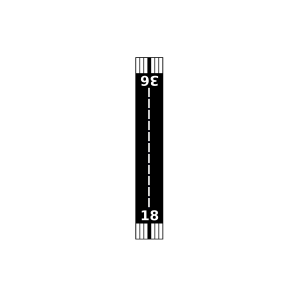
18/36 180°/0° - -

Wettervorhersage (DWD)

Station:
Keine Wetterdaten vorhanden.

Flugplätze in der Nähe

Rancho Hielo Brazos Airport 4 km - -
Circle P Ranch Airport 9 km - -
Circle Eight Ranch Airport 10 km - -
Running M Ranch Airport 12 km - -
Flat Top Ranch Airport 12 km - -
Wyatt 3-Rivers Airport 13 km - -
Bryant's Landing Airport 15 km - -
Pastrana Ranch Airport 18 km - -
Little 'L' Ranch Airport 19 km - -
Parker Airport 21 km - -
Devil's Finger Airport 22 km - -
Ray Smith Farm Airport 23 km - -
Doublewide Ranch Airport 24 km - -
Flying 5B Ranch Airport 24 km - -
Diamond Seven Ranch Airport 25 km - -
Pecan Plantation Airport 26 km - -
Goatneck Airport 26 km - -
Boyd Airport 26 km - -
The Landings Airport 28 km - -
Spring Creek Field 30 km - -
Nassau Bay Airport 30 km - -
Putty Ranch Airport 30 km - -
KGDJ Granbury Regional Airport 31 km METAR TAF
J F Ranch Airport 33 km - -
KSEP Stephenville Clark Regional Airport 33 km METAR TAF
W4 Ranch Airport 34 km - -
White Stone Ranch Airport 36 km - -
Francis Ranch Airport 37 km - -
Talley Airport 39 km - -
Circle 'A' Ranch Airport 41 km - -
Parrish Airstrip Airport 42 km - -
Aresti Aerodrome Airport 42 km - -
KCPT Cleburne Regional Airport 43 km METAR TAF
Lake Whitney Country Club Airport 43 km - -
Driftwood Ranch Airport 45 km - -
Chicken Strip Airport 45 km - -
Cade Field 45 km - -
Horseshoe Bend Airport 45 km - -
Fainting Goat Airport 45 km - -
Clifton Municipal/Isenhower Field 46 km - -
Hawkins Field 46 km - -
Chigger Field 47 km - -
Dublin Municipal Airport 48 km - -
Benjamin Franklin Airport 48 km - -
Buffalo Chips Airpark 48 km - -
Cross Wind Acres Airport 49 km - -
Blackwood Airpark 50 km - -
Alle Angaben ohne Gewähr. Daten nur zu Demozwecken verwenden!