logo
freizeitwetter .info
Impressum Nutzungsbedingungen Attributions

© Schulkreis.de e.K.
Freizeitwetter.info Version 3.5.4

Alle Angaben ohne Gewähr. Daten nur zu Demozwecken verwenden!

KORS

Orcas Island Airport


0 km/h
Flugplatzdetails
WetterinfoMETAR TAF
Koordinaten48.7083W 122.9106E
TypMidsized airport
LandUnited States (Vereinigte Staaten von Amerika) weitere Länder...
Gehört zuEastsound
Orte in der Nähe Friday Harbor, Marietta, Birch Bay, Marietta-Alderwood, Ferndale, Anacortes, Bellingham, Point Roberts, Blaine, Douglas,
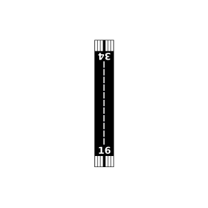
Landebahnen 16/34
Fluginformation (FIR)Seattle
Umgebungskarte Orcas Island Airport

Anflug-Informationen

Klicke den Kompass an, um die Landebahn in Position zu drehen.
0 km/h

Landebahn-Informationen

Liste der verfügbaren Landebahnen, vermutlich aktive Piste hervorgehoben.
Runway RWY-Richtung Seitenwind Gegenwind
16/34 180°/0° - -

Wettervorhersage (DWD)

Station:
Keine Wetterdaten vorhanden.

Flugplätze in der Nähe

Crow Valley Airport 7 km - -
Rosario Seaplane Base 8 km - -
Waldron Airstrip Airport 8 km - -
Clam Harbor Airport 10 km - -
Westsound/WSX Seaplane Base 11 km - -
Deer Harbor Seaplane Base 13 km - -
CWEZ Saturna Island Meteorological Aeronautical Presentation System 13 km - -
Wilding Farm Airport 15 km - -
Blakely Island Airport 16 km - -
Windsock Airport 19 km - -
Roche Harbor Airport 20 km - -
Stuart Island Airpark 20 km - -
Friday Harbor Seaplane Base 20 km - -
Fishermans Bay Seaplane Base 21 km - -
Roche Harbor Seaplane Base 21 km - -
Friday West Airport 22 km - -
Lyall Harbour Seaplane Base 22 km - -
Stuart Island West Airport 22 km - -
KFHR Friday Harbor Airport 22 km METAR TAF
Decatur /Jones/ Airport 23 km - -
Bedwell Harbour Seaplane Base 24 km - -
Decatur Shores Airport 24 km - -
Eliza Island Airport 25 km - -
Center Island Airport 25 km - -
Lopez Island Airport 25 km - -
Burden Field-(Rabbit Run) 27 km - -
KBLI Bellingham International Airport 29 km METAR TAF
CWZO Kelp Reefs, B. C. 30 km - -
Anacortes Airport 30 km - -
Skyline Seaplane Base 30 km - -
Point Roberts Airpark 32 km - -
Cutty Field 33 km - -
Horse Fly Airport 33 km - -
Meadowmist Airport 34 km - -
CWWK White Rock Automatic Weather Reporting System 36 km - -
Intergalactic Aerodrome 37 km - -
Lakesamish Seaplane Base 38 km - -
CYYJ Victoria International Airport 39 km METAR TAF
Michell Airpark 39 km - -
Bayview Farms Airport 39 km - -
Becker's Landing Airport 39 km - -
Victoria Airport 40 km - -
CWDR Discovery Island 40 km - -
CWYJ Victoria University 41 km - -
Floathaven Airstrip Airport 41 km - -
Delta Heritage Air Park 41 km - -
CZBB Vancouver/Boundary Bay Airport 41 km METAR TAF
Floathaven Seaplane Base 42 km - -
Lynden Municipal/Jansen Field 43 km - -
King George Airpark 44 km - -
KNUW Whidbey Island Naval Air Station (Ault Field) 44 km METAR TAF
CWLM Victoria Automatic Weather Reporting System 44 km - -
Long Harbour Airport 45 km - -
KBVS Skagit Regional Airport 45 km METAR TAF
CWVV Vic. Hartland Automatic Weather Reporting System 45 km - -
Ganges Seaplane Base 46 km - -
CYWH Victoria Harbour Seaplane Base 46 km - -
Westwind Airport 47 km - -
CYNJ Langley Airport 48 km - -
CWPF Esquimalt Harbour, B. C. 49 km - -
Riverside Airport 49 km - -
Butler Field 50 km - -
Alle Angaben ohne Gewähr. Daten nur zu Demozwecken verwenden!