logo
freizeitwetter .info
Impressum Nutzungsbedingungen Attributions

© Schulkreis.de e.K.
Freizeitwetter.info Version 3.5.4

Alle Angaben ohne Gewähr. Daten nur zu Demozwecken verwenden!

US-D367

Roche Harbor Airport


0 km/h
Flugplatzdetails
Wetterinfo- -
Koordinaten48.6123W 123.1385E
TypSmall airport
LandUnited States (Vereinigte Staaten von Amerika) weitere Länder...
Gehört zuRoche Harbor
Orte in der Nähe Friday Harbor, Saanich, Gordon Head, Sidney, Cordova Bay, Cadboro Bay, Saanichton, Central Saanich, North Saanich, Oak Bay,
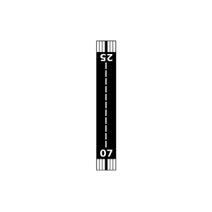
Landebahnen 07/25
Fluginformation (FIR)Seattle
Umgebungskarte Roche Harbor Airport

Anflug-Informationen

Klicke den Kompass an, um die Landebahn in Position zu drehen.
0 km/h

Landebahn-Informationen

Liste der verfügbaren Landebahnen, vermutlich aktive Piste hervorgehoben.
Runway RWY-Richtung Seitenwind Gegenwind
07/25 70°/250° - -

Wettervorhersage (DWD)

Station:
Keine Wetterdaten vorhanden.

Flugplätze in der Nähe

Roche Harbor Seaplane Base 2 km - -
Stuart Island Airpark 7 km - -
Stuart Island West Airport 10 km - -
Deer Harbor Seaplane Base 10 km - -
CWZO Kelp Reefs, B. C. 10 km - -
Friday West Airport 11 km - -
Friday Harbor Seaplane Base 13 km - -
KFHR Friday Harbor Airport 13 km METAR TAF
Westsound/WSX Seaplane Base 14 km - -
Clam Harbor Airport 14 km - -
Waldron Airstrip Airport 14 km - -
Crow Valley Airport 14 km - -
Wilding Farm Airport 15 km - -
Bedwell Harbour Seaplane Base 17 km - -
Burden Field-(Rabbit Run) 18 km - -
Michell Airpark 19 km - -
Fishermans Bay Seaplane Base 19 km - -
KORS Orcas Island Airport 20 km METAR TAF
Windsock Airport 20 km - -
CWEZ Saturna Island Meteorological Aeronautical Presentation System 20 km - -
Rosario Seaplane Base 20 km - -
Lopez Island Airport 21 km - -
Lyall Harbour Seaplane Base 21 km - -
CWYJ Victoria University 22 km - -
CYYJ Victoria International Airport 22 km METAR TAF
CWDR Discovery Island 23 km - -
Blakely Island Airport 23 km - -
Victoria Airport 23 km - -
CWLM Victoria Automatic Weather Reporting System 25 km - -
CWVV Vic. Hartland Automatic Weather Reporting System 26 km - -
Center Island Airport 26 km - -
Decatur Shores Airport 27 km - -
CYWH Victoria Harbour Seaplane Base 27 km - -
Decatur /Jones/ Airport 27 km - -
CWPF Esquimalt Harbour, B. C. 29 km - -
CWKH Malahat Automatic Weather Reporting System 33 km - -
Skyline Seaplane Base 36 km - -
Shawnigan Lake Seaplane Base 36 km - -
Long Harbour Airport 37 km - -
Anacortes Airport 37 km - -
Ganges Seaplane Base 38 km - -
Point Roberts Airpark 41 km - -
Eliza Island Airport 41 km - -
Maple Bay Seaplane Base 41 km - -
Quamichan Lake (Raven Field) Seaplane Base 43 km - -
Quamichan Lake (Raven Field) Airport 44 km - -
Duncan Airport 45 km - -
CWQK Race Rocks Automatic Weather Reporting System 45 km - -
KNUW Whidbey Island Naval Air Station (Ault Field) 46 km METAR TAF
Becker's Landing Airport 47 km - -
KBLI Bellingham International Airport 48 km METAR TAF
Alle Angaben ohne Gewähr. Daten nur zu Demozwecken verwenden!